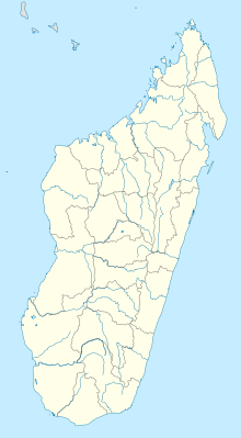
Ambalabe Airport
Appearance
This article needs additional citations for verification. (July 2015) |
Ambalabe Airport | |||||||||||
|---|---|---|---|---|---|---|---|---|---|---|---|
| Summary | |||||||||||
| Airport type | Public | ||||||||||
| Operator | ADEMA (Aéroports de Madagascar) | ||||||||||
| Serves | Antsohihy | ||||||||||
| Location | Sofia Region, Madagascar | ||||||||||
| Elevation AMSL | 92 ft / 28 m | ||||||||||
| Coordinates | 14°53′49″S 47°59′38″E / 14.89694°S 47.99389°E | ||||||||||
| Map | |||||||||||
 | |||||||||||
| Runways | |||||||||||
| |||||||||||
Ambalabe Airport is an airport in Antsohihy, Sofia Region, Madagascar (IATA: WAI, ICAO: FMNW).
15°46′27″S 46°57′11″E / 15.7741°S 46.953°E
References
[edit]- ^ "WAI Runway Information". Airport Guides. Retrieved 1 July 2015.
- ^ "WAI Airport Data". AirportGuide. Retrieved 1 July 2015.

